
总述:
Based on the “space-air-ground” integration data acquisition model, making use of satellite remote sensing, aerial remote sensing, tilt photography, laser radar, 720 panorama, VR and other technologies, and serving for public security, environmental protection, water conservancy, communications, electricity, land, agriculture and other industries, MAPUNI provides customers with overall customized intelligent map solutions with multi-source, multi-dimension, and multi-scale geographic information.
业务分类:
-
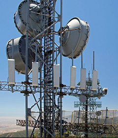
Communication Business
The product lines in this industry contain data products and...
-

Energy Business
MAPUNI can provide technical support for smart grid operatio...
-

Financial Business
MAPUNI mainly focuses on insurance business, supplemented by...
-

Public Security Emergency Business
The application for Public Security is established based on ...
-

Natural Resources Business
Relying on remote sensing, big data and the Big Map service ...
-
>
The product lines in this industry contain data products and software services, including high-precision elect...